
What to Expect During a Central Texas Construction Site Evaluation
A construction project can look workable on paper and still run into trouble once the site is studied closely. In Central Texas, that trouble might come from expansive clay, shallow limestone, a floodplain boundary, protected trees, drainage limits, an unexpected utility conflict, or a permitting requirement tied to a specific city, county, or watershed.
A site evaluation helps find those issues before crews mobilize, budgets harden, and schedules become harder to change. It gives owners, architects, engineers, builders, and lenders a clearer picture of what the land can support, what it may cost to prepare, and which approvals must be secured before work begins.
For any Central Texas construction project, the evaluation is more than a box to check. It is the point where the design meets the land.
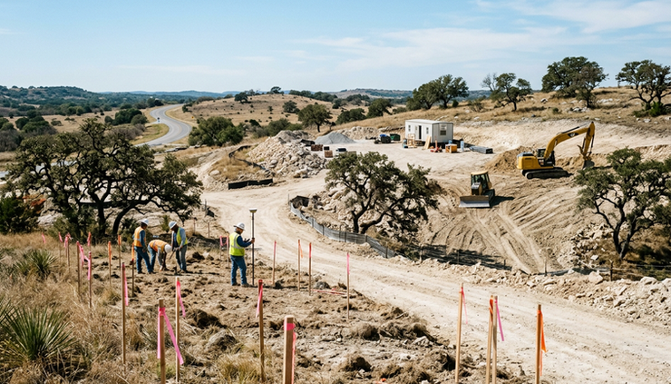
Why the site evaluation matters before construction begins
A site evaluation answers a simple question with many moving parts: Can this project be built here as planned?
The answer rarely comes from one inspection. It comes from a group of studies that look at soil, drainage, access, utilities, vegetation, environmental constraints, code requirements, and construction logistics. In Central Texas, those factors can vary sharply from one property to the next. A site near a creek in Austin may face different floodplain and water quality requirements than a rural parcel in Williamson County or a commercial pad in San Marcos.
A thorough evaluation helps the project team:
Confirm that the proposed building location works with the land
Identify site preparation needs before pricing is finalized
Reduce the risk of foundation movement, drainage failures, and erosion
Support permit applications with the right technical reports
Avoid delays tied to missing documents or agency comments
Make better decisions about grading, utilities, access, and phasing
Skipping or rushing this step can cost far more than the evaluation itself. A poorly understood site may require redesign after permits are submitted. It may need unplanned foundation upgrades, drainage revisions, retaining walls, tree mitigation, or utility relocations. Those changes can affect construction costs, loan timing, lease commitments, and opening dates.
Site evaluation also protects long-term performance. Central Texas weather can bring long dry periods, intense storms, flash flooding, and quick changes in soil moisture. A good evaluation helps the design team account for those realities instead of reacting to them after damage occurs.
For owners, the biggest value is clarity. The evaluation turns assumptions into documented conditions. That makes project decisions less speculative and gives every participant a stronger basis for pricing, design, and scheduling.
What professionals look at during a site evaluation
A site evaluation is usually not handled by one person. It may involve a civil engineer, geotechnical engineer, surveyor, environmental consultant, arborist, architect, utility locator, and local permitting specialist. The exact team depends on the size, location, and risk profile of the project.
Smaller residential projects may need a limited review, while commercial, multifamily, institutional, or industrial projects often require a broader set of studies. The goal is the same in both cases: gather enough reliable information to design and permit the project with fewer surprises.
Boundary, topographic, and site survey
Most evaluations begin with a survey. A boundary survey confirms property lines, easements, rights-of-way, and encroachments. A topographic survey maps existing grades, drainage paths, visible utilities, pavement, buildings, fences, trees, and other site features.
This information becomes the base for design. If the survey is outdated or incomplete, the rest of the design can be affected.
A Central Texas survey often pays close attention to:
Slope and natural drainage patterns
Creeks, low-water crossings, and flood-prone areas
Existing driveways and roadway access points
Utility easements and overhead lines
Tree locations and trunk sizes
Rock outcrops and steep grades
Adjacent development that may affect runoff
The survey can also reveal conflicts early. For example, a planned building footprint may overlap with a utility easement, or a proposed driveway may need a different location to meet local sight-distance standards.
Geotechnical and soil testing
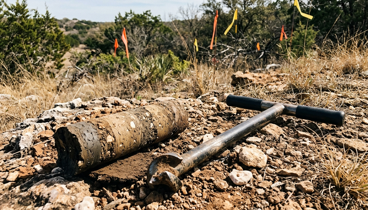
Soil testing is one of the most important parts of a Central Texas site evaluation. The region includes expansive clays, caliche, limestone, fill material, shallow rock, and mixed soil profiles. These conditions can affect foundations, pavement, retaining walls, septic systems, and underground utilities.
A geotechnical engineer may collect soil borings, perform lab tests, review groundwater conditions, and provide recommendations. The final geotechnical report often addresses:
Foundation type and bearing capacity
Soil expansion potential
Excavation conditions
Pavement design
Site grading recommendations
Subgrade preparation
Moisture control
Retaining wall design values
Expansive clay deserves special attention. These soils can swell when wet and shrink when dry. That movement can stress slabs, pavements, sidewalks, and utility lines. The solution may involve a specific foundation design, moisture conditioning, select fill, drainage controls, or deeper foundation elements.
Shallow limestone can create a different set of issues. It may improve bearing capacity in some areas, but it can make excavation slower and more expensive. Rock profiles can also vary across a site, which affects utility trenching and pier drilling.
The geotechnical report should be shared with the structural engineer, civil engineer, architect, and contractor. It should not sit in a project folder unread. Many costly field changes start when geotechnical recommendations fail to make their way into the drawings and specifications.
Drainage, floodplain, and stormwater review
Water is one of the most important forces on any site. In Central Texas, intense rain can produce fast runoff, especially on sloped land, shallow soils, and developed surfaces. A drainage review looks at how water enters, crosses, and leaves the property.
The evaluation may include:
Existing drainage patterns
Low points and ponding areas
Upstream runoff entering the site
Downstream discharge points
Floodplain boundaries where mapped
Detention or retention needs
Water quality requirements
Erosion risks during and after construction
For projects near creeks, rivers, or mapped flood hazard areas, the team may need to review Federal Emergency Management Agency flood maps and local floodplain rules. Some jurisdictions in Central Texas apply stricter standards than minimum federal requirements. Building near a floodplain can trigger elevation, access, compensatory storage, or no-rise requirements.
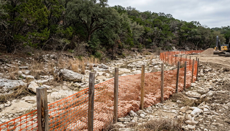
Stormwater rules may also require erosion and sediment control plans. Larger projects may need coverage under state stormwater construction regulations and a stormwater pollution prevention plan. Even small projects can face local requirements for silt fence, stabilized construction entrances, inlet protection, and disturbed-area controls.
Drainage problems are easier to solve during design than after occupancy. A site evaluation should flag whether the planned grades, building elevation, driveway layout, and discharge points will work under real storm conditions.
Environmental and natural resource review
Environmental review varies by site, but it can become a major factor in Central Texas. The region includes sensitive watersheds, karst features, endangered species habitat in some areas, protected trees, riparian corridors, and aquifer recharge zones.
A typical environmental review may look for:
Wetlands or waters of the United States
Stream buffers and riparian areas
Protected habitat
Karst features such as caves, voids, or sinkholes
Aquifer recharge concerns
Existing contamination or prior land use risks
Trees protected by city or county rules
Vegetation that affects grading or fire safety
Some sites need a Phase I Environmental Site Assessment, especially for commercial transactions, lender requirements, or properties with industrial, agricultural, automotive, dry-cleaning, or fuel storage history. A Phase I review identifies recognized environmental concerns based on records, site observations, and historical use. If concerns arise, additional testing may be recommended.
In parts of the Hill Country and the Austin area, karst and aquifer-related issues can carry special weight. Voids, caves, and fractured limestone may affect drainage, water quality, foundation design, and regulatory review. Where the Edwards Aquifer or related recharge features are involved, project teams should expect closer attention to water quality and erosion controls.
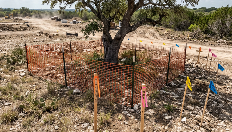
Tree preservation can also affect site planning. Mature live oaks and other significant trees may limit where grading, utilities, parking, or buildings can go. A certified arborist may need to document tree size, species, health, and protection zones.
Utility availability and conflicts
A buildable site still needs service. The evaluation should confirm whether water, wastewater, power, gas, telecommunications, and fire protection can support the proposed use.
Utility review often includes:
Existing utility locations
Available capacity
Tie-in points
Easements and access rights
Required extensions
Meter locations
Fire hydrant spacing and flow
Septic feasibility where public sewer is not available
Central Texas includes fast-growing cities, small towns, utility districts, and rural areas. Service rules can differ from one provider to another. A property may sit inside a city limit, an extraterritorial jurisdiction, a municipal utility district, a water supply corporation, or a county area with limited public infrastructure.
Early utility coordination helps prevent late design changes. For example, a site may have water nearby but no sewer connection at the required depth. A fire line may need a larger main extension. A septic system may need more land than expected because of soil conditions and setback requirements. Power service may require easements, transformer space, or off-site upgrades.
Access, traffic, and constructability
Site access matters for both the finished project and the construction phase. A site evaluation should look at how vehicles, pedestrians, emergency responders, deliveries, and construction equipment will enter and move through the property.
For projects along state-maintained roads, driveway permits or access approvals may involve the Texas Department of Transportation. Local streets may require city or county driveway approval. Commercial projects may need traffic impact analysis, turn lane review, fire lane layout, or pedestrian connectivity.
Constructability review focuses on how the work will happen in the field. This includes staging, temporary access, material storage, equipment movement, worker parking, erosion controls, and neighbor impacts. Tight urban lots, steep Hill Country parcels, and sites near active roads all need careful planning.
A project may be fully code-compliant on paper and still difficult to build if there is no room for cranes, concrete trucks, soil stockpiles, or safe equipment circulation.
Local regulations and permits to expect in Central Texas
Permitting in Central Texas depends heavily on location. The requirements for a project in Austin, Round Rock, Georgetown, Temple, New Braunfels, San Marcos, Waco, or an unincorporated county area can differ in meaningful ways.
This section provides general information, not legal advice. Project teams should confirm requirements with the authority having jurisdiction and qualified local professionals.
City, county, and extraterritorial rules
A site may fall under several layers of review. A city may control building permits, zoning, site plan approval, tree protection, drainage, and utility connections. A county may review subdivision plats, driveway access, floodplain development, or on-site sewage facilities. In an extraterritorial jurisdiction, a city may have some development authority even if the property is outside city limits.
Common local approvals may include:
Zoning verification or rezoning
Site development permit
Building permit
Grading permit
Demolition permit
Driveway permit
Floodplain development permit
Tree removal or tree preservation approval
Subdivision plat or replat
Utility service approval
On-site sewage facility permit
Fire department review
The order matters. Some jurisdictions will not accept building permit documents until site plan review is complete. Others may require utility commitments, drainage approvals, or plat recordation first.
A permit matrix can help organize the process. This is a simple document that lists each expected approval, the reviewing agency, required submittals, expected sequence, and known dependencies.
Review item | Common reviewing authority | Why it matters |
Site plan or development review | City or county staff | Confirms layout, access, drainage, utilities, and code compliance |
Floodplain review | Local floodplain administrator | Protects life, property, and downstream areas |
Stormwater controls | City, county, or state agency | Reduces erosion, sediment discharge, and runoff impacts |
Driveway access | City, county, or TxDOT | Confirms safe access to public roads |
Septic approval | County or authorized local agent | Confirms wastewater treatment can work on-site |
Tree protection | City or local jurisdiction | Preserves regulated trees and defines protection measures |
Building permit | Building department | Confirms code compliance before construction |
State and environmental requirements
Some projects may involve state or federal review. The Texas Commission on Environmental Quality may be involved with stormwater permits, Edwards Aquifer-related requirements, water quality issues, or certain waste and environmental matters. The U.S. Army Corps of Engineers may be relevant when wetlands or jurisdictional waters are present. Texas Parks and Wildlife concerns may arise if protected species or habitat issues are identified, depending on the project and location.
Not every project will need these reviews. The point of the site evaluation is to decide whether any of them apply early enough to avoid delay.
Building codes and local amendments
Texas jurisdictions commonly adopt versions of model building codes, often with local amendments. These codes affect structural design, fire protection, accessibility, energy performance, plumbing, mechanical systems, and electrical work. Local amendments can change requirements for fire access, sprinkler systems, wind design, energy compliance, or inspection procedures.
A site evaluation does not replace full building code analysis, but it can identify site-driven code issues. Fire lane grades, hydrant locations, emergency access, accessible routes, and building setbacks often depend on site conditions.
How to prepare for the evaluation
Good preparation makes the site visit and technical review more useful. It also reduces repeat trips, incomplete reports, and missed questions.
Before the evaluation, gather as much existing information as possible. Even if some documents are old, they can help consultants understand what to verify.
Useful documents include:
Current deed or title information
Existing boundary or topographic surveys
Plats, easements, and recorded restrictions
Prior geotechnical reports
Prior environmental reports
Utility maps or service letters
Floodplain information
Conceptual site plans
Architectural drawings
Drainage reports, if available
Tree surveys or arborist reports
Septic records or permits
Zoning verification or land use information
Photos of known problem areas
Construction access notes
A clear project description also helps. Consultants need to know the proposed use, building size, approximate footprint, pavement areas, number of stories, expected loads, utility needs, and schedule goals. A vague plan leads to vague recommendations.
Mark known site features
Before field teams arrive, identify visible features that may not be obvious from maps. This can include old wells, septic tanks, buried debris, drainage swales, former building pads, soft spots, standing water, retaining walls, or undocumented utility lines.
If the site is large, provide access notes. Locked gates, livestock, steep drives, low-water crossings, dense brush, and unsafe structures can slow the work or prevent completion.
Coordinate access and safety
Site evaluators may need to bring drilling rigs, survey equipment, drones where allowed, utility locating tools, or sampling gear. Make sure they can access the property safely and legally.
Preparation may include:
Unlocking gates
Notifying tenants or occupants
Clearing heavy brush in targeted areas
Identifying overhead power lines
Marking private utilities
Confirming livestock control
Sharing known hazards
Providing permission for drilling or sampling
For geotechnical borings, the team should coordinate utility locates before drilling. Public utility locate services may not mark private lines, irrigation, septic components, or abandoned utilities, so owners should share any records they have.
Ask the right questions early
A site evaluation is more useful when the project team agrees on key questions before fieldwork begins. Good questions include:
What foundation risks does the soil create?
Will the site need import or export of fill?
Can the proposed grading work without major retaining walls?
Does the site discharge runoff safely?
Are there floodplain or water quality constraints?
Could trees, habitat, or karst features affect the layout?
Are utilities available at the capacity the project needs?
Will access require city, county, or TxDOT approval?
What permits control the critical path?
Which findings could affect the budget most?
These questions guide the consultants toward practical answers, not just generic observations.
What happens during the actual site visit
The site visit may last a few hours for a small property or several days for a larger or more complex project. Some studies require return visits, especially when drilling, environmental sampling, tree assessment, or detailed survey work is involved.
A typical visit may include a walk-through of the property, photo documentation, field notes, measurements, test locations, and review of visible conditions. Team members may compare the site against available plans and public mapping.
Expect evaluators to look at both the proposed building area and the surrounding context. Neighboring grades, drainage channels, road frontage, off-site utilities, and downstream discharge points can affect feasibility.
During fieldwork, professionals may:
Locate property features and site constraints
Confirm access points and sight lines
Observe soils, rock, vegetation, and drainage
Identify erosion and sediment concerns
Mark boring or sampling locations
Review tree locations and condition
Check utility evidence such as manholes, meters, poles, and valves
Photograph areas that may affect design or permitting
The best site visits include open communication. If the owner or project manager knows about recurring ponding, past flooding, buried structures, illegal dumping, or seasonal access problems, that information should be shared. Local knowledge can save time and prevent incorrect assumptions.
Common challenges on Central Texas sites and ways to address them
Central Texas sites can be rewarding to build on, but they often require careful planning. The challenges below are common enough that project teams should watch for them early.
Expansive soils and foundation movement
Expansive clay can affect slabs, sidewalks, pavements, and flatwork. Dry weather can shrink the soil, while heavy rain can swell it. Over time, that movement can cause cracking or uneven settlement.
Ways to address it include:
Commission a geotechnical report early
Follow foundation recommendations in the structural design
Use proper moisture conditioning during pad preparation
Design drainage to move water away from foundations
Avoid placing landscaping irrigation too close to building edges
Include subgrade preparation requirements in the construction documents
The key is consistency. A strong foundation design can still perform poorly if grading sends water toward the building or if the subgrade is not prepared as specified.
Shallow rock and excavation costs
Limestone can be close to the surface in many parts of Central Texas. That can affect utility trenches, building pads, detention ponds, pier drilling, and stormwater structures.
Ways to address it include:
Use geotechnical borings to estimate rock depth
Discuss rock excavation assumptions before bids are finalized
Adjust utility routes where practical
Plan for suitable equipment and production rates
Keep contingency funds for variable subsurface conditions
Rock is predictable in some areas and highly variable in others. Early testing gives the contractor better information for pricing and scheduling.
Flash flooding and drainage constraints
Central Texas storms can produce intense rainfall in a short period. Sites near creeks, low crossings, or steep drainage paths need special care.
Ways to address it include:
Confirm floodplain status early
Study upstream and downstream drainage patterns
Set finished floor elevations with adequate margin
Provide stable discharge points
Use erosion control before disturbing soil
Keep drainage paths clear during construction
Drainage design should account for both code requirements and practical field performance. Water will follow gravity, not the intent shown on a plan.
Permitting delays
Permitting delays often come from incomplete submittals, unclear jurisdiction, missing technical reports, or late agency comments. Fast-growing Central Texas communities may also have heavy review workloads.
Ways to address it include:
Confirm the reviewing agencies before design advances too far
Create a permit matrix
Schedule pre-application meetings where available
Submit complete plans and reports
Track comments and responses in writing
Build review time into the project schedule
A realistic schedule is better than an optimistic one that fails at the first agency review.
Tree preservation and site layout conflicts
Many Central Texas sites include mature live oaks, cedar elms, pecans, and other trees that shape the site plan. Local rules may protect certain trees based on species, size, or location.
Ways to address it include:
Complete a tree survey early
Involve an arborist before grading plans are fixed
Protect root zones during construction
Route utilities away from major roots where practical
Plan staging areas outside tree protection zones
Tree conflicts become harder to solve after the building, parking, and utility layouts are set.
Utility capacity and service extensions
A property may have utilities nearby but still lack the capacity or connection points needed for the proposed project. This is common in growing areas where infrastructure is catching up with development.
Ways to address it include:
Contact utility providers early
Request service availability information
Confirm fire flow needs
Review easement requirements
Identify off-site extension needs
Include utility lead times in the schedule
Utility delays can affect permits, construction start, and occupancy. Early coordination reduces that risk.
What the final evaluation report should include
The final deliverables depend on the scope, but a useful site evaluation should do more than describe conditions. It should explain what those conditions mean for the project.
A strong report or evaluation package may include:
Site summary and project assumptions
Survey data or base mapping
Soil and geotechnical findings
Foundation and pavement recommendations
Drainage and floodplain observations
Environmental constraints
Tree and vegetation notes
Utility availability findings
Access and traffic considerations
Permit and jurisdiction summary
Photos, maps, and exhibits
Risks that need more study
Recommended next steps
The best reports separate confirmed findings from items that still need verification. They also identify decisions that affect cost or schedule.
For example, a report might state that the initial site layout appears feasible, but a detention pond will require more space, a driveway location needs TxDOT review, and the proposed building pad may require select fill based on soil conditions. That level of clarity helps the design team respond before plans advance too far.
How to use the findings after the evaluation
A site evaluation only creates value if the team uses it. After receiving the reports, schedule a review with the owner, architect, civil engineer, structural engineer, contractor, and key consultants. The goal is to connect each finding to a design, permit, budget, or schedule decision.
Focus the follow-up discussion on these points:
Which findings affect the site layout?
Which findings affect the foundation or structural design?
Which findings affect the civil drawings?
Which permits are now confirmed?
Which items need more study?
Which risks need budget contingency?
Which recommendations must appear in the construction documents?
This step helps prevent a common problem: technical reports are completed, but their recommendations do not make it into the final drawings. If the geotechnical report calls for specific subgrade preparation, the plans and specifications should reflect it. If the drainage review assumes certain grading, the site plan should match. If tree protection is required, the contractor should see it before work begins.
A good evaluation reduces risk before it becomes expensive
A Central Texas Construction Site Evaluation gives a project team a practical view of the land, the rules, and the likely construction challenges. It can confirm that a plan is sound, reveal changes that need to happen, and help set a realistic path through permitting and construction.
The most valuable evaluations happen early, before major design decisions are locked in. They look at soil, drainage, utilities, environmental limits, access, local permits, and field logistics as connected parts of one project. That complete view helps avoid surprises once crews arrive.
For owners and developers, the next step is simple: gather the available property records, clarify the project goals, and bring in qualified local professionals before design moves too far. A well-timed site evaluation will not remove every risk, but it will make the important ones visible while there is still time to address them.

Comments